Mapping Climate Stories to Share Solutions by The Map of Stories
Please find below the
Finalist Evaluation
Judges'' comments
This is an interesting proposal but the scope seems way too broad. Sharing stories can be extremely effective, but people are easily overwhelmed by the amount of climate information available, and are usually looking for solutions that pertain to their local conditions. This is hard to deliver through the proposed approach. Communities and individuals need stories of sufficient length and detail to convey specific information they can use and apply. This will be hard to capture in the media testimonials proposed here. Also, several tools to map vulnerability to sea level rise already exist, so the initial GIS effort seems a bit redundant. Finally, while this project may be effective in identifying at-risk communities, is it not clear how it would communicate resilience. Identifying risk is only the beginning of the process; we also need to inspire and motivate communities to take action to decrease their vulnerability.
Semi-Finalist Evaluation
Judges'' ratings
| • | Novelty: | |
| • | Feasibility: | |
| • | Impact: | |
| • | Presentation: |
Judges'' comments
This is a very nice idea, and we like the idea of people being able to share their stories through multiple media and across political and geographic boundaries. It’s also a great idea to use existing data and networks such as the Planet Forward, Fulbright NEXUS, and InVEST.
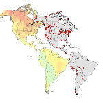
There are a few questions you might provide more information or clarification on. (1) Why North and South America? Might have more impact if it’s more focused on a single region. Conversely, if the project has a very broad geographic area, why restrict it to only two continents? (2) The proposed cost also seems way too low for such an ambitious project. It’s not clear that $150,000 would be enough to cover even the web developer, much less travel costs, even if the travel is strategically planned. (3) The multimedia aspect of the interface is a strength, but how do you collect data from all the different media to demonstrate the highest risk sites? And how do you differentiate areas that have high risk from those that have high participation?
Finally, we would like more information on how you plan to engage people and motivate them to take action to decrease their vulnerability or increase resilience. If the stories found on the site will be from groups that are already taking adaptation measures, how do you reach the people who need that information?
No comments have been posted.